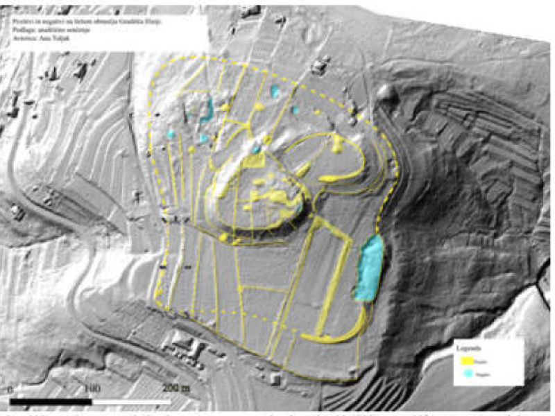
Interpretation of LiDAR data of the Elerji hillfort
The document “Preparation of the Airborne Laser Scanning Analysis, Supported by Topographic Analysis (Field Survey) of the Kaštelir–Elerji Hillfort Area”, prepared within the framework of the Interreg Italy–Slovenia KAŠTellieri project, presents the results of a comprehensive study of the archaeological site of Kaštelir near Elerji.
The study combines LiDAR data analysis (airborne laser scanning) with detailed topographic survey and field investigations, enabling the identification, mapping, and interpretation of archaeological structures that are no longer directly visible today due to vegetation cover and landscape transformations.
The document outlines the geomorphological and historical context of the area, examines the chronology of the prehistoric settlement, and provides a detailed description of the digital data processing methodology (DTM, analytical visualizations, slope and visibility analyses).
The results include a map of the identified surface structures, an interpretation of the archaeological remains, and an analysis of the acropolis topography. The research represents an important professional and scientific basis for the protection, enhancement, and future planning of the archaeological park, ensuring an updated scientific framework for the sustainable management and promotion of cultural heritage.
The document can be viewed at the following link: Interpretation of LiDAR Elerji